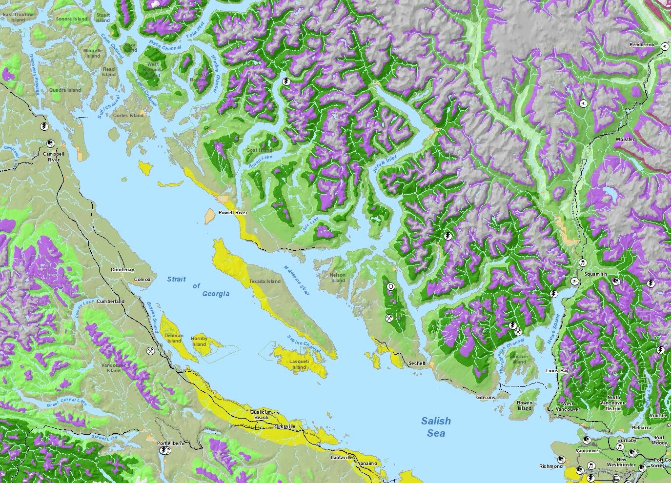
Spatial Analysis, Modelling, and Data Visualization
GIS Solutions
We translate business requirements and raw data into creative solutions and compelling visuals.
Campbell Geospatial excels at identifying and applying analytical techniques and solutions for clients in the environmental and municipal sectors. We use the latest geospatial technology to provide practical solutions to effectively support decision making from project conception through execution, and project delivery.
Services

Mobile Solutions for Field Programs
Campbell Geospatial offers a complete service to support your field programs geospatial needs, including; survey location planning, custom hard copy field maps, and creation of mobile data collection apps.

Web Maps, and Asset Management Tools.
We use ESRI web technology to create robust, intuitive web maps with tools to streamline workflows, while empowering staff with access to your organizations maps and data.

Data Processing, Analysis, and Modelling
We use advanced spatial analysis and modelling to identify geospatial patterns and relationships in your data. We have expertise in:
Predictive Modelling
Wildlife Habitat Modelling
Interpreting TEM
Contaminated Sites Mapping and Modelling
Hydrological Modelling
Visual Quality Modelling
LiDAR and Orthoimagery interpretation
Photogrammetry
Least Cost Path Analysis

Custom Carto, Data Visualization, and Tabular Outputs
Communicate your data and knowledge with dynamic web maps and compelling cartographic products.
Other Services
We pride ourselves in using our experience and creativity to identify and execute custom and practical geospatial solutions to meet and exceed your unique business needs.